


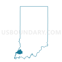
WHITE RIVER 01, Gibson County, Indiana
About
Outline

Summary
| Unique Area Identifier | 577275 |
| Name | WHITE RIVER 01 |
| County | Gibson County |
| State | Indiana |
| Area (square miles) | 35.60 |
| Land Area (square miles) | 34.47 |
| Water Area (square miles) | 1.13 |
| % of Land Area | 96.82 |
| % of Water Area | 3.18 |
| Latitude of the Internal Point | 38.41630800 |
| Longtitude of the Internal Point | -87.61831780 |
Maps


Graphs
Select a template below for downloading or customizing gragh for WHITE RIVER 01, Gibson County, Indiana


Neighbors
Neighoring Voting District (by Name) Neighboring Voting District on the Map
- DECKER, Knox County, IN
- MONTGOMERY 03, Gibson County, IN
- MT CARMEL 1 Voting District, Wabash County, IL
- MT CARMEL 2 Voting District, Wabash County, IL
- MT CARMEL 5 Voting District, Wabash County, IL
- PATOKA 12, Gibson County, IN
- PATOKA 13, Gibson County, IN
- WASHINGTON, Gibson County, IN
- WHITE RIVER 02, Gibson County, IN
Top 10 Neighboring County Subdivision (by Population) Neighboring County Subdivision on the Map
- Patoka township, Gibson County, IN (11,864)
- Mount Carmel precinct, Wabash County, IL (8,389)
- Montgomery township, Gibson County, IN (3,996)
- White River township, Gibson County, IN (1,689)
- Washington township, Gibson County, IN (785)
- Decker township, Knox County, IN (227)
Top 10 Neighboring Place (by Population) Neighboring Place on the Map
Top 10 Neighboring Unified School District (by Population) Neighboring Unified School District on the Map
- North Gibson School Corporation, IN (14,338)
- South Gibson School Corporation, IN (12,317)
- Wabash Community Unit School District 348, IL (10,927)
- South Knox School Corporation, IN (6,205)
Top 10 Neighboring State Legislative District Lower Chamber (by Population) Neighboring State Legislative District Lower Chamber on the Map
- State House District 109, IL (103,405)
- State House District 108, IL (102,103)
- State House District 64, IN (60,833)
Top 10 Neighboring State Legislative District Upper Chamber (by Population) Neighboring State Legislative District Upper Chamber on the Map
- State Senate District 55, IL (213,429)
- State Senate District 54, IL (204,199)
- State Senate District 48, IN (121,761)
- State Senate District 49, IN (113,960)
Top 10 Neighboring 111th Congressional District (by Population) Neighboring 111th Congressional District on the Map
Top 10 Neighboring Census Tract (by Population) Neighboring Census Tract on the Map
- Census Tract 9559, Knox County, IN (5,670)
- Census Tract 504.02, Gibson County, IN (4,173)
- Census Tract 501, Gibson County, IN (4,026)
- Census Tract 504.01, Gibson County, IN (3,443)
- Census Tract 9575, Wabash County, IL (2,870)
- Census Tract 9574, Wabash County, IL (2,156)
Top 10 Neighboring 5-Digit ZIP Code Tabulation Area (by Population) Neighboring 5-Digit ZIP Code Tabulation Area on the Map
- 47670, IN (12,352)
- 62863, IL (10,183)
- 47665, IN (3,637)
- 47666, IN (1,447)
- 47640, IN (1,089)
- 47524, IN (605)